Mar 20 2008

A Typical Day in the Galapagos

Published by under Galapagos,South America

Most people visit the Galapagos by boat which is what we did. You’d think it would be a lazy, relaxing way to see things – just cruising around by boat. There’s where you’d be wrong. They pack your day. It was tough to find free time and when we went to bed, we were exhausted. I know, I know: trouble in paradise. At the beginning of our trip, the naturalist on board said that he’d know people were happy if he saw that they were really tired at night. I have seen that idea mentioned before but it was in the context of training dogs. I suspect there’s a connection in there somewhere.

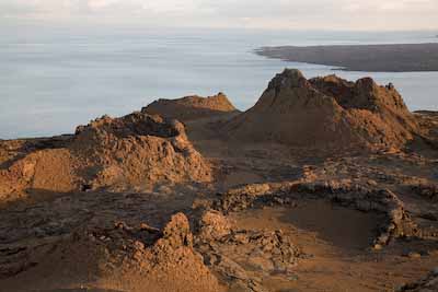
Every day’s activities varied a bit and there was even a day or two in there that were very different (spending the day in the town of Puerto Ayora on Santa Cruz Island for instance). That said, there was a “standard” set of things in most days. Here’s a typical one of those:

5:45: Wake-up call. Ugh. I paid to be treated like this? Seriously though, we got up early because the animals are not as active in the mid-day heat. It also meant we were usually first onto the island ahead of groups from other boats.

6:00: Breakfast. Food on board was very good. Nothing gourmet but good and plentiful. For certain, no one ever went hungry.

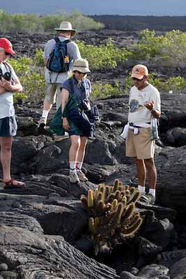
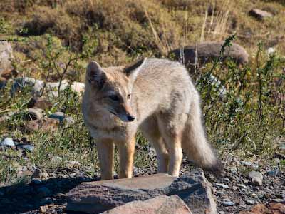
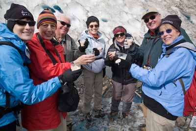
6:45: Ride the dinghy to an island for a 2-3 hour guided walk. Some dry landings, some wet. In addition to the passengers and crew, the two other people on board are a tour leader and a naturalist. Martin Loyola was our naturalist extraordinaire who grew up in the Galapagos. He would lead our walks and was a wealth of knowledge about all things having to do with plants, wildlife, and geology.

martin.jpg

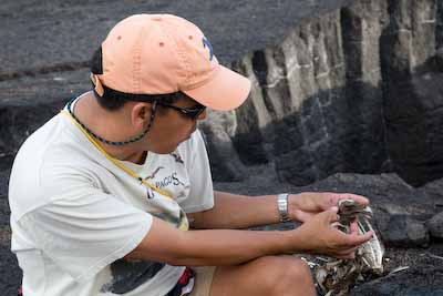
Martin explains features of a hawk skull.

9:30: Return to ship and prepare for snorkeling. This always felt great because even though it was still morning, we were always already extremely hot and sweaty. It was very hot and humid every day.

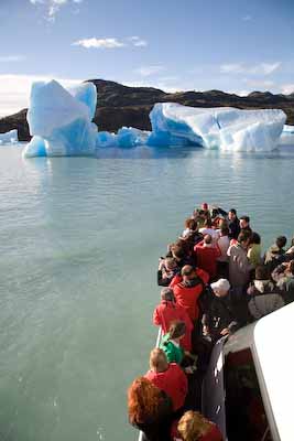
10:00: Snorkeling. The water was almost always warm and very clear. Martin led these as well and would frequently dive to the bottom to point things out.

12:00: Eat lunch and then rest. People usually spent time on the top deck looking for dolphins or whales.

3:00: Dinghy ride again to shore for another nature walk.

groupwithsealion.jpg

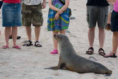
The group and a sea lion. Yes, you can get this close.

groupandpanga.jpg

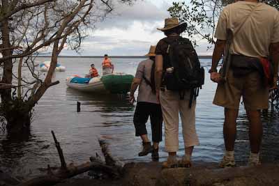
Waiting for the dinghy after a walk.

6:30: Back on the boat, the tour leader gives a lecture on relevant topics such as evolution, formation of the islands, local wildlife, history of people in the islands, etc. Our tour leader was Richard Parsons who was taking a break from running his lodge named Bellavista in the mainland cloud forest. Richard assisted Martin on every activity and, like Martin, he had very deep knowledge about anything we could ask him, told entertaining stories, and had a great sense of humor.

richard.jpg

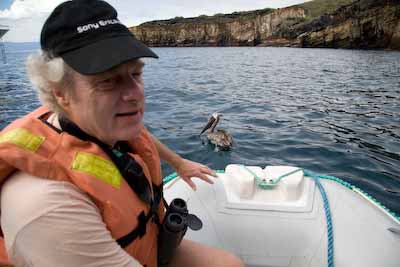
Richard and a Brown Pelican.

7:00: Dinner.

8:00: Martin gives a short briefing on activities and schedule for the following day.

8:30: Most people went to bed. I tended to stay up with one or two others to work on that day’s photographs.

Overnight: The boat typically navigates to a new island while people are in bed.

One response so far

Mar 18 2008

Geology of the Islands

Published by under Galapagos,South America

I am no geologist, so this will obviously be a short post. But I thought a good place to start talking about the islands would be in their formation in the first place. BTW, my Aunt Wendy is sharing the blog with her students in Waterloo, NY (hi kids!), so I feel some responsibility to do some educational posts and also feel some pressure to get things right. My dad knows a lot more about this stuff than I ever will, so maybe he can make some informative comments.

The Galapagos Islands were formed by volcanic activity. If you want proof, look at this picture:

Spatter Cones

Spatter Cones on Bartolome Island

There is a “hot spot” below the seabed in the islands, which is essentially a place where magma escapes through the earth’s crust. As the tectonic plate that the seabed sits on moved above that fixed hot spot over a period of millions of years, the islands were formed. Because the tectonic plate is moving west to east, the oldest islands in the Galapagos are in the east (some of which have eroded to the point that they are completely covered by water again), and the youngest are in the west (Fernandina is the youngest, and is currently located right above the Galapagos hot spot, so its volcanoes are still active). Scientists believe the various islands are between 1 and 10 million years old. You can learn more about hot spots and plate tectonics by clicking here. Many islands and island chains around the world were formed this way, including Hawaii. The thing I find fascinating about this subject is that the theories of plate tectonics and hot spots were so recently formed. People didn’t know much about this stuff just 50 years ago.

Many of the hikes we did on the trip were on lava. One of the days (when we were on Fernandina Island), we walked on a massive lava flow – it was one of my favorite walks. Relatively soon after lava cools (very soon, in geologic terms), some plant species can grow in what seems like impenetrable black rock. Here are a couple pictures from that walk:

Lava Walk

Lava Flow
Scenes from our Lava Walk

Well, I don’t think I’ve said anything inaccurate about volcanic activity, so I’m going to quit while I’m ahead. Keep this topic in mind though, because it is one of the important factors in the discussion about evolution and why plants and animals are different in the Galapagos than they are in other places.

3 responses so far

Mar 18 2008

Radio Silence Is Over

Published by under Galapagos,South America

We’re back in mainland Ecuador after an amazing trip to the Galapagos. We have several posts about the Galapagos to follow this post, and lots of pictures – we hope to get them posted within the next few days.

I’ve updated the itinerary page to match the sites we visited during the trip. Here is a map of the route we took through the Galapagos Islands on our 11-day live-aboard journey (it starts and ends at Baltra Island, which is where the main airport is, and runs in a counter-clockwise direction):

Map of Galapagos Route

Here is a different map of the islands with a little more detail:

Detailed Map

We hardly know where to start to describe the trip. The Galapagos Islands are quite overwhelming (in a good way!) because of the insane amount of flora and fauna, in addition to the many geologic, scientific and conservation topics to discuss. I’m 100% sure that we won’t do justice to these topics, and we’re not going to provide an exhaustive lecture on everything we learned in the Islands. We will touch on some of the things we found fascinating, and in some cases, we’ll provide links to third-party information for those of you who want to learn more.

Some of you have been to the Galapagos Islands. For those who have not, it is a unique experience and I cannot recommend it enough! There are a few different ways to see the islands – we went on a small live-aboard motor yacht with 15 passengers, a tour leader, a naturalist guide, and the ship’s crew. There are also cruises on larger live-aboard ships which may provide more amenities (laundry service would have been nice – we were hiking and snorkeling at the equator after all!), but the larger ships may not be able to travel to all of the islands due to the carrying capacity of the ship. There are also hotels on Santa Cruz Island and many operators that run day-trips around the islands. We chose our operator because it was one of the few who runs trips for longer than one week. We weren’t disappointed, but we also agree that any way you get to see this incredible place is worthwhile. For us, the most important aspect was that we had an excellent guide (Martin Loyola) and tour leader (Richard Parsons).

I hope you enjoy the upcoming posts (remember to read from the bottom up, and definitely look at Dave’s incredible pictures), but keep in mind that the best way to experience this place is to go yourself!

Comments Off on Radio Silence Is Over

Mar 06 2008

Top 8 Unexpected Things In Patagonia

Published by under Patagonia,South America

Sure this is late. Sure we left Patagonia a while ago. So I found these notes lying around 2 weeks later. You know you’ll still enjoy them. Here’s a short list of the unexpected aspects of the Patagonia portion of this trip:

  1. The ice cream is excellent in Argentina (not so much Chile). It’s very rich and creamy with lots of strong flavors.
  2. Seeing penguins and armadillos in the same place.
  3. Wild cows near Lago Onelli. I prefer to call them feral cows. Sounds more dangerous and therefore we look more adventurous if we say we hiked near them.
  4. It stays light out until 10:30pm.
  5. The pilot’s strike that affected Aerolineas Argentina (and therefore us) when we arrived.
  6. Aside from ice cream in Argentina, the flavors for sweet things like snacks or desserts (chocolate, caramel, etc.) are very weak. Sometimes I only knew something was caramel from the label. We had a chocolate cake in El Chalten that had no chocolate flavor and we all agreed it had a slight taste of caraway seeds. Weird.
  7. The great weather. Patagonia is known for unpredictable weather and for being extremely windy. It has been rainy or overcast only a little. It’s mainly sunny with a few clouds. We only experienced high winds during the day when crossing the high plains of the border between Argentina and Chile. Though there was that one night in El Chalten where we thought the winds were going to blow the hotel down.
  8. Almost every single meal had some form of ham & cheese. We must have eaten a whole pig while we were there. The thing is, we see lots of cows, sheep, etc. when we drive around. Where do all the pigs we keep eating come from?

One response so far

Mar 06 2008

Yeah, Well What About These Pictures?

Published by under Patagonia,South America

Dave is an incredibly talented photographer. But how about some of these shots that *I* took:

Dave Doing His Thing

Dave Doing What He Does

Guanaco Doing What It Does

Guanaco Doing What It Does

Taking It All In

Taking It All In

Grey Fox

A Fox Who Thought I Had Food

5 responses so far

Mar 06 2008

Pictures Posted

Published by under Patagonia,South America

The downside is that we’re supposed to be in Quito, Ecuador by now but due to some missed connections, we’re in a hotel in Lima, Peru tonight and will get to Quito tomorrow mid-day. The upside is that we finally have a fast Internet connection again so I’ve posted a few galleries of pic’s so far. Just some quick edits for now, nothing fancy in terms of image enhancement. Here’s a link to pictures from the first portion of the trip on Peninsula Valdes. Then try here for pictures from El Chalten. Onward to pictures from El Calafate. Finally, there are a few pictures from Torres del Paine in Chile. Hope you enjoy them!

We’ve also updated a few of the past posts below with a few pictures.

One response so far

Mar 05 2008

Farewell To Patagonia!

Published by under Patagonia,South America

We´re getting ready to go to the airport to travel to the Galapagos. Last night we had our farewell dinner with our tour group.

The Group on the Last Night

Last Group Picture

We had dinner in a private room at our hotel in El Calafate. When we arrived, we saw a slideshow of pictures that one of our tour leaders, Melissa, took on the trip. They were great photos of both landscapes and people.

After a tasty dinner and some of that fabulous Argentine red wine, our tour leaders Irene and Melissa said some really nice things about all of us and the trip, Dave showed some of the pictures he has taken, and I sang “I´ll Be Seeing You”, which I thought was an appropriate goodbye song. 🙂

We had an amazing time in Patagonia, and we made many new friends. Dave and I have met people on every trip we´ve been on. Usually, we find one or two that we bond with and keep in touch with afterward. This trip to Patagonia is different – we plan to keep in touch with everyone we met. Such a warm, friendly, interesting group of people. And they have our blog address now, so, I´ll officially welcome Irene, Melissa, Alex, Cathy, Rainer, Joy, David, Laurie, Jim and Donna to our blog.

3 responses so far

Mar 05 2008

Where are We Now?

Published by under Patagonia,South America

In our last episode, we were in El Calafate, about to leave to cross the Chilean border and enter Torres del Paine National Park. It was a long day of travel but it was sunny and the views were outstanding which made it pretty pleasant. When you enter the high plains near the border, the winds accelerate to an incredible level. It was amazing. We got out to take the cliche picture of me near the “Welcome to Chile” sign and the second I stepped off the bus, my hat flew off and I spent the next minute or two chasing it down the road. Every time I thought I had it, I’d reach out for it and it would blow away. Like a cartoon. The rest of the group had a good laugh.

The “Paine” in Torres del Paine was a local native word for blue so the name means “The Blue Towers”. Although the park is very large and contains many lakes, glaciers, and other mountains, the centerpiece is a set of spires made mostly of granite but, due to a quirk of formation, each has a band of darker, sedimentary rock at the top (the “blue”). We stayed at a ranch, did several hikes while there, and had a great drive around the park. It was incredibly hot but we took a hike out to a lunch spot one day that overlooked a turquoise lake with mountains behind it. Outstanding views! The guides said that just a couple of weeks before, the winds were so strong (which apparently is typical) that that group could not make it that far down the trail.

I was able to spend an early morning heading out before sunrise to a decent spot to photograph the alpenglow on the towers. The shots came out very well.

We fly out of El Calafate in a few hours to travel to Quito (via Lima).Since we’ll have no Internet on the boat in the Galapagos, we’ll try to post one last time before leaving Quito. Ciao.

2 responses so far

Feb 29 2008

Membership Has Its Privileges

Published by under Patagonia,South America

Today we took a boat ride to view several glaciers and icebergs. When we got to the boat at the dock, our guide confidently led us past rows and rows of seats already teeming with eager tourists laden with cameras, binoculars and extra fleece. I was starting to get a little worried that all the seats were taken, when our guide opened a door at the front of the boat labeled, “The Captain’s Club”.

The Captain’s Club

Enter All Ye Who Have a VIP Badge

It seems we had arrived. Literally, at least to our seats. One of the nice things about going on a tour is that you don’t have an itemized list of the cost of each activity. If we were travelling on our own, we might have said, “VIP section? We’re not worth all that fuss. We don’t need to pay extra. Let’s just go in the regular section.” However, it was pretty sweet.

The best perk of living the high life on our all-day navigation around Lago Argentino and its surrounding glaciers was the ability to see everything. In The Captain’s Club (“TCC” from now on), we had two private decks from which we could view glaciers and icebergs for the 16 privileged people in the VIP section (Dave got some great pictures). We could also see the people who were not VIPs (commonly referred to by those in TCC as “the masses” or “steerage”) on their viewing deck below.

Glacier Cruise 1

View from TCC down onto “the masses”

As you can see, there’s not nearly enough room on these lower decks for the 150 people on the catamaran that were in steerage. I think they actually had to take turns in order to take pictures. At one point in the trip, I felt like going out on to the TCC viewing deck and singing “Don’t Cry for Me Argentina” to the people below.

One other perk about being in TCC was the fact that we were able to go down to the bar and get soda, coffee, tea and water for free, instead of paying (we all had badges, properly identifying us as members of TCC). However, I know some of us were quite afraid of going out amongst the masses in order to obtain our liquid refreshment – you never know who might get jealous of our higher stature and iceberg viewing position. So, it was a very good thing that we found out that we could also order drinks from an attendant in TCC named Daphne. Whew!

Half-way through the trip, one of the crew members was able to pull up a small chunk of ice from the pristine water. We all got a piece in a glass, over which Daphne poured some Scotch (don’t worry Dad – it was a blend, not a single malt, so the ice didn’t ruin it!). It was quite tasty.

Dave High Life David & Laurie High Life

Dave and Other TCC Members Living the High Life

Unfortunately, like all good things, this excursion came to an end. But it was fun while it lasted, and we got some great pictures.

2 responses so far

Feb 29 2008

Glaciers and Massifs

Published by under Patagonia,South America

We’ve had a great time in the Argentinian side of Patagonia the last few days. After spending last weekend on Peninsula Valdes seeing wildlife, we flew south to El Calafate which is the launching point for glacier viewing and rock climbing. The word Calafate is the Spanish word for caulk. When early explorers needed to repair their ships, they needed a resin to do so and, because there were no native trees, they finally found it in the berries of a local bush. They named the bush Calafate and, since there was a lot of that bush in this area, they called the town the same name.

We didn’t linger in El Calafate – we came back to it a few days later. Instead, we immediately drove a couple hours to a town named El Chalten which is small and quaint (it reminds me of Homer, Alaska) and basically has three types of businesses: hotels, restaurants, and stores that sell climbing gear. It seems to be populated mainly by young, outdoorsy types (read: bohemian climbing bums). It’s the town where almost everyone who intends to climb the Fitz Roy Massif or Cerro Torre launches their effort.

Although this trip is not a photo-centric one, I did get some quality photography in Tuesday morning. I got up before sunrise so that I could catch the morning alpenglow on the Fitz Roy Massif. After that, we went on a 10-mile hike via the Fitz Roy basecamp. We passed many scenic views of amazing mountains and glaciers around us. It was a long haul for some in the group and after it, many of us enjoyed a cold Quilmes, the local beer. I thought I found a little slice of heaven when I soaked my feet in the hot shower but then I found out that one of the other guys on the trip put a chair in his bathroom and soaked his feet in the bidet!

Fitz Roy Massif

Picture of the Fitz Roy Massif at Sunrise

The next day we took a boat across Lago Viedma to the Viedma Glacier for a glacier hike. We hiked to the base of the glacier and strapped on some crampons and spent the next few hours exploring peaks and ice caves. The lower ice that has been compressed under the weight of the glacier is an amazingly deep and intense blue. I hope my pictures do it justice. When we were at the highest point of our hike, our guides surprised us by chipping some ice out of the side of a wall and handing out cups filled with the ice and some Bailey’s. The best Bailey’s I’ve had in a while. 🙂

Glacier Hike

Baileys with Glacier Ice

Pictures from our Glacier Hike

Yesterday, we drove back to El Calafate in the afternoon and today we spent the entire day on a boat in Lago Argentino looking at larger glaciers – the Spegazzini, the Upsala, and the Onelli. It was incredible to be on a boat floating past vast icebergs that have calved off of the glaciers. Most had melted into smooth forms, some round, some angular, some blue, and some clear.

Glacier Cruise 1

Glacier Cruise 2

Pictures from our Glacier Cruise

Tomorrow is a travel day. We’re driving all day across the Chilean border to Torres del Paine. We’ll spend three nights there, hiking and exploring the mountains. Talk to you soon!

One response so far

« Newer Entries - Older Entries »